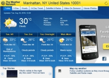
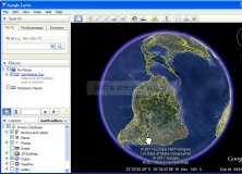
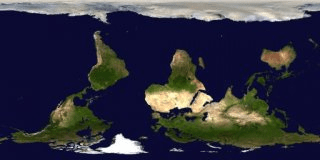
EarthBrowser is sort of a multi-purpose map application. This application needs the Adobe Air mainframe to work, which means that you can use this application with several operative systems, like Windows and Mac OS X. The application starts with a 3D image of the Earth. There, you can use your mouse to pan and zoom to any city in the world. The application doesn't actually show you every city in the World, but most are there. You can configure the application to show you clouds, storm fronts, and weather items nearby. I don't know how precise this is. I was looking out the window and I saw some clouds that weren't on the map, but maybe this isn't real-time. Earthbrowser shows satellite maps, but they are not as accurate as Google's. Perhaps they use a different source of imagery. Still, if it worked in real-time, they application uses would be vast. Anyway, simply zooming and panning around a 3D map of the Earth is always fun. Earthbrowser comes with an inbuilt Internet Browser, and apparently, if you live in the US, you can watch real-time imagery of icebergs breaking down and forest fires. I wouldn't take this application as a 100% accurate warning measure, though.


Comments (1)